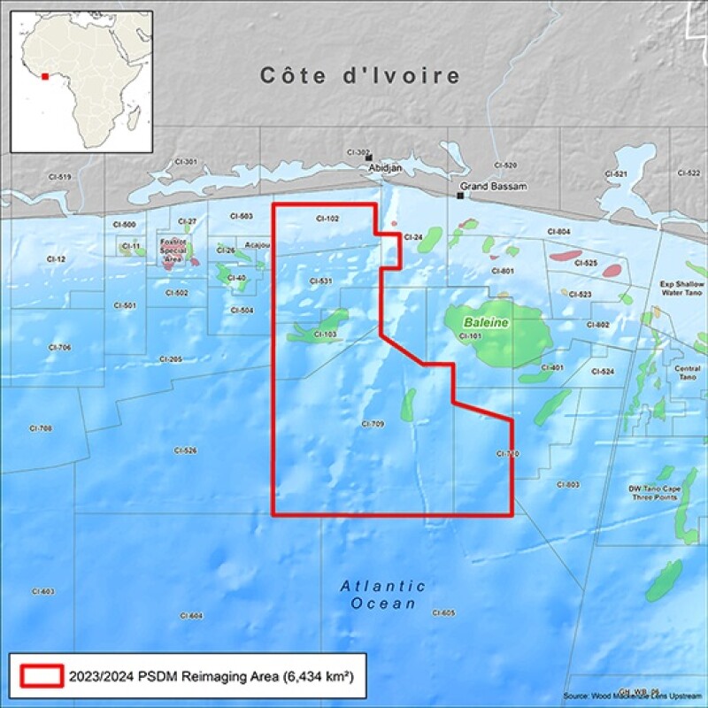
CGG has announced the start of a major new multi-client 3D prestack depth migration reimaging program in the Tano Basin offshore Côte d’Ivoire. The 6,400-km2 reimaged seismic data set near the recently discovered Baleine field aims to provide insight into this high-potential play. The project is supported by industry funding and is expected to be complete by the end of 2024, with a fast-track volume available in the first quarter of 2024.
“The recent discovery of the Baleine field has led to heightened exploration interest in offshore Côte d’Ivoire,” said Dechun Lin, CGG’s executive vice president for Earth data. “Our reimaging project is the first of its kind to utilize cutting-edge technology to enable confident evaluation at a prospect as well as regional level, to give a better picture of the subsurface in this world-class basin. The resulting ultramodern data set will offer unique access to near-field exploration opportunities, placing IOCs a step ahead in fast-tracking the development of these high-impact prospects.”
CGG said it plans to reimage the 3D seismic data with its latest proprietary technologies, including time-lag full waveform inversion (FWI) and the potential application of targeted FWI imaging. The team also plans to conduct a regional interpretation of the project area to provide a better understanding of the distribution of the highly prospective clastic and carbonate plays in the Tano basin.